There are huge numbers of waterfalls in the South Island of New Zealand. Even limiting oneself to the
good-sized ones, it would take a resident of South Island, which I am not, years to visit them all. This page just lists
a very few that I happen to have seen (not all of them exactly good-sized ones...).
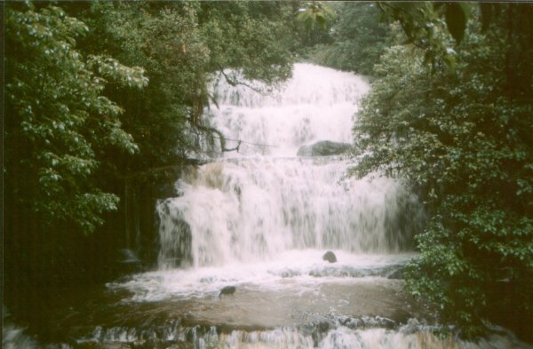
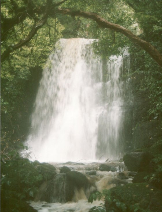
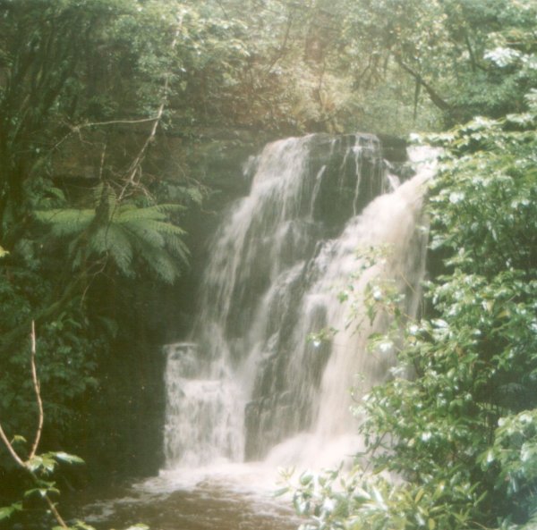
The Catlins is an area of low bush-clad hills in the south-east corner of South Island.
It has a few reasonably attractive waterfalls of notably modest size. Since I went and looked and took
photos of them, I'll put them up.
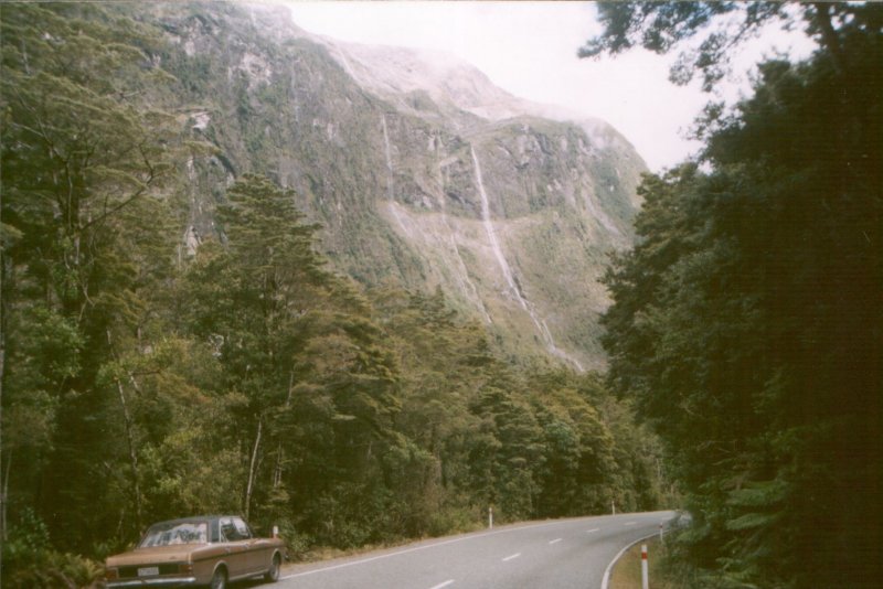
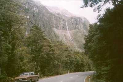
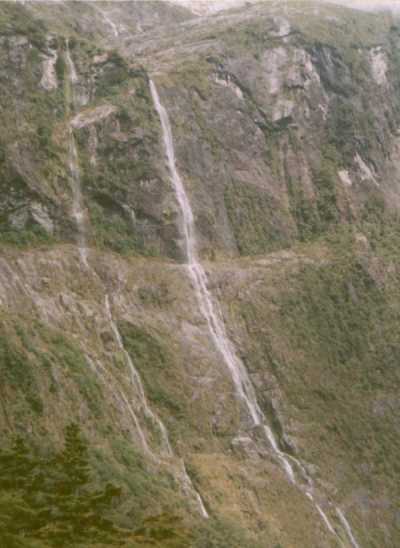
The road to Milford Sound is one of the most scenically dramatic journeys in the country.
The mountains, rising straight from the sea, together with the prevailing westerly winds,
result in a very high rainfall in the valleys and snowfall on the peaks, and the great
volume of snow on the tops means that the snowfields last right over summer. All this, together
with the steep mountainsides, makes this a land of waterfalls. Many of them are just un-named
streams that pour down the valley sides from the snow-melt.
Any mentions below to contours, or heights on the map refer to the 1:50,000 contour maps published by
LINZ (Land Information New Zealand), and available online at NZtopoOnline.
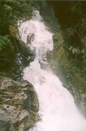 |
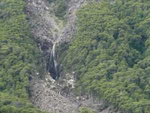
Falls Creek
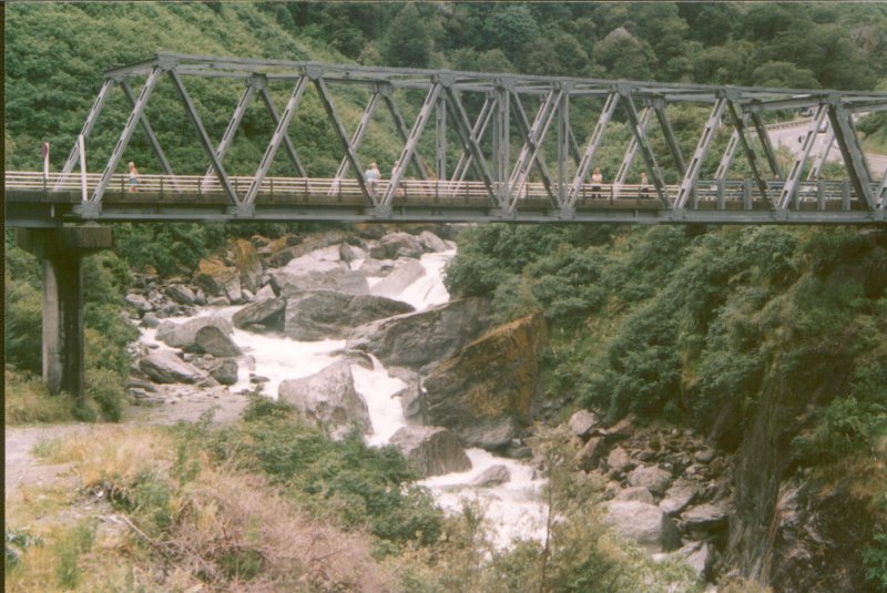
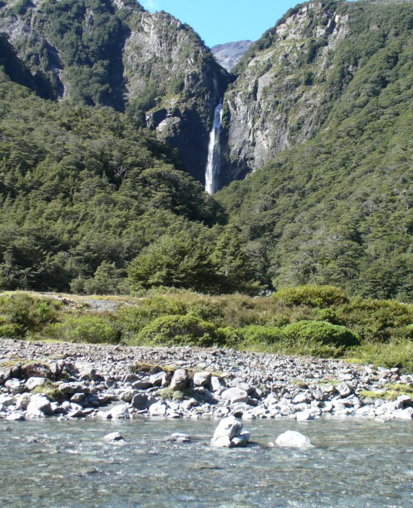
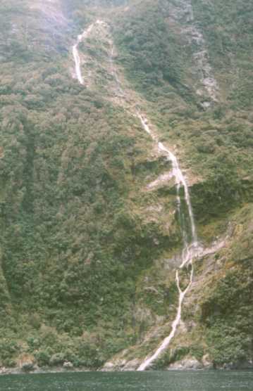
The Hollyford Valley is a classic U-shaped glacial valley with high mountains
on each side. Just after the Milford road enters the valley and winds down the valley
side, it crosses Falls Creek, a stream which cascades down the valley side in its own
little gorge. This lowest fall is said to be 15m (50 feet) high, though judging by the
map, there could be many more back up the gorge. |
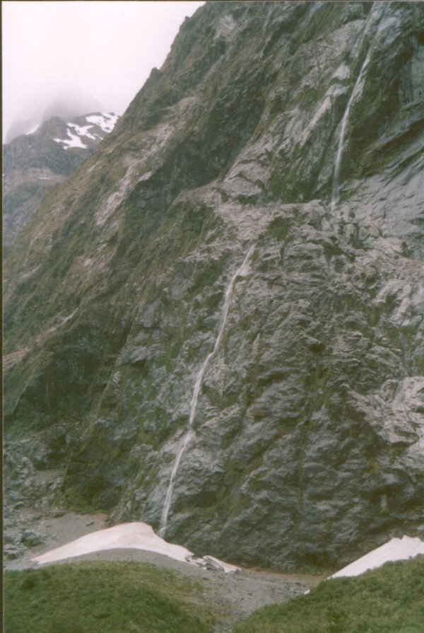
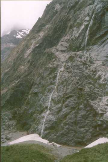
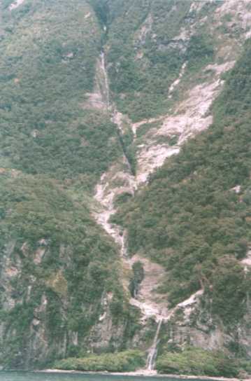
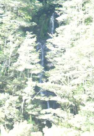
A little further on, an un-named stream cascades down the cliff face from the melting
snow on Mt Christina above.
Even though this is midsummer, and only 1500 feet above sea level, the cold air descending
from the snowfields above means that snowdrifts persist in the valley. It's a remarkable
local climate; 60 miles due east, on the hot dry plains around Cromwell,
fruit is being picked in the orchards. |
|
|
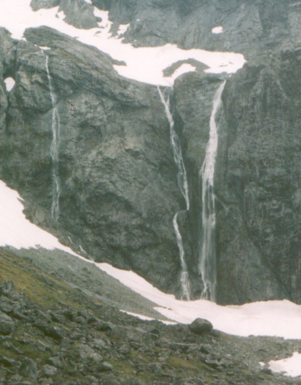
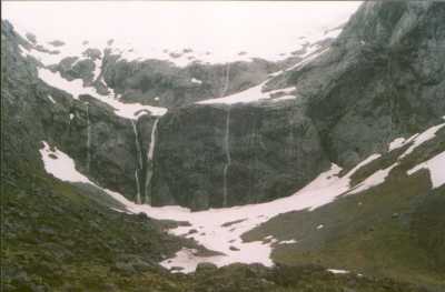
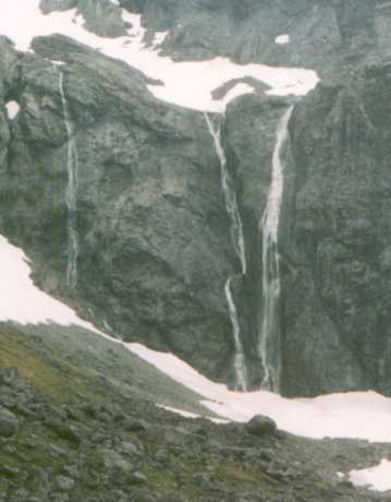
At the head of the Hollyford Valley, an amphitheatre with waterfalls all round. |
|
The main cliff there is 160m (520 feet) high (from the map). |
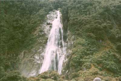
| Beyond the Homer Tunnel, in the Cleddau Valley, a fall cascades down the slopes of Sheerdown Peak. |
|
| The map quotes the height of the fall as 203m (666 feet), but this is just the upper
section. The contours show the top of the cliff at 620m and the slope easing at 400m (which would
be the ledge across the middle of the photo). However the steep slope continues down to 150m,
behind the trees, making a total drop, including the steep cascade, of 470m (1540 feet). |
|
|
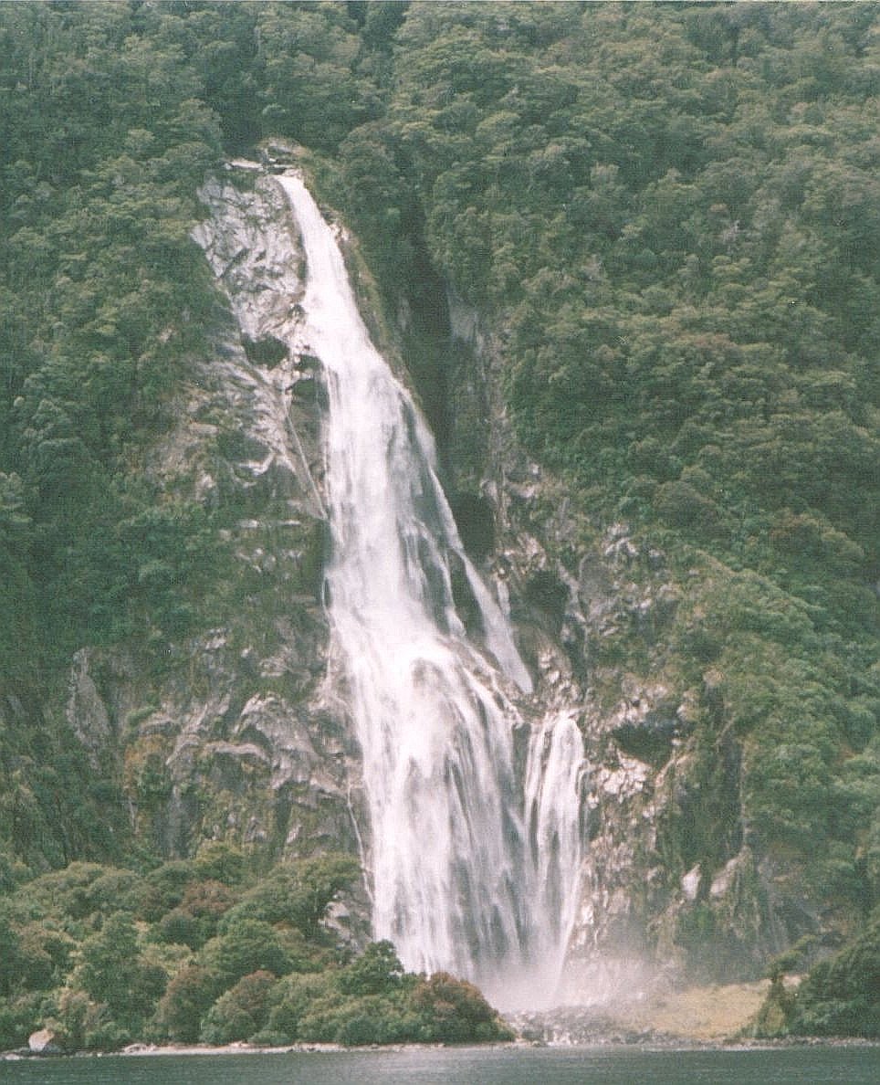
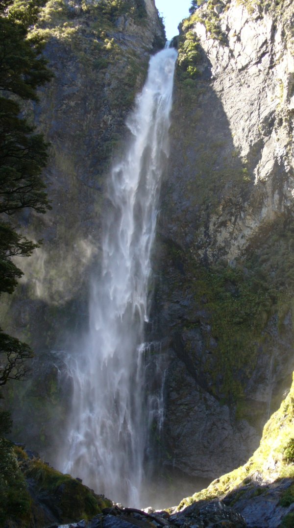
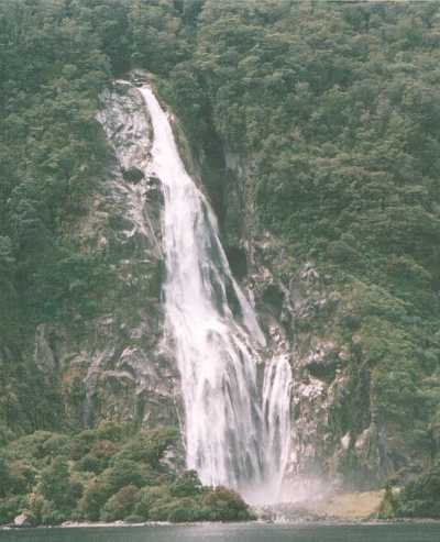
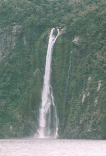
Bowen Falls
Bowen Falls is the most dramatic falls I know. The busy landing stage for the tourist boats on Milford
Sound is just 300 yards away on the other side of the ridge (just off to the right of the picture), but
there is no sign or sound of the falls from the wharf. As the boat sails into the sound, the falls
appear without warning and dramatically close, behind the boat. |
|
The falls are 530 feet (162m) high; a photo can't do justice to the impression they make in
reality. Those are big trees clustered around the base of the falls, dwarfed by the mountain slopes.
It's hard to convey a sense of scale in the photo. You have to be there.
(Height from NZTO). |
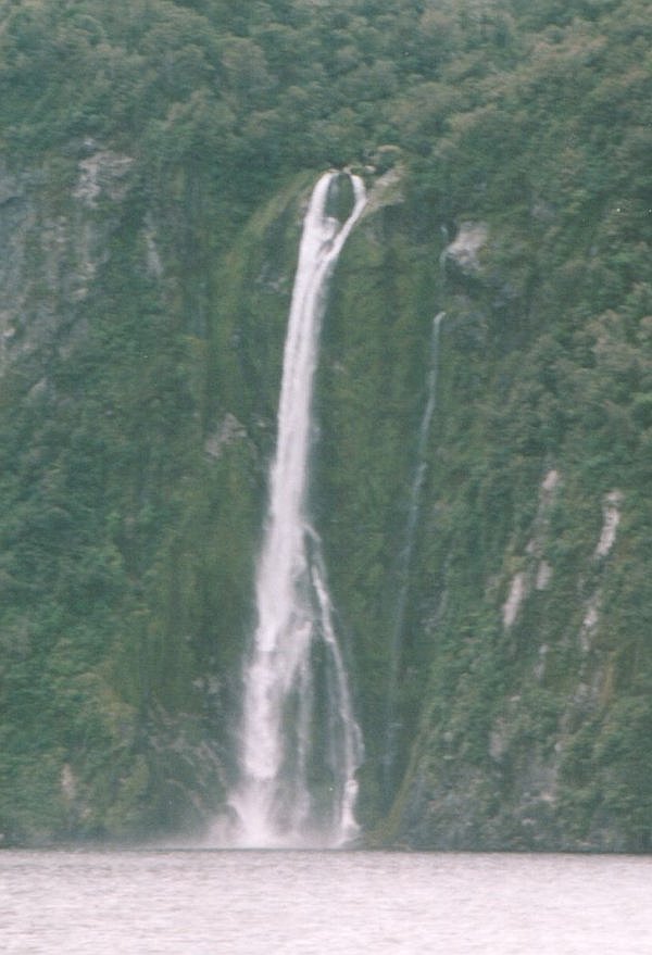
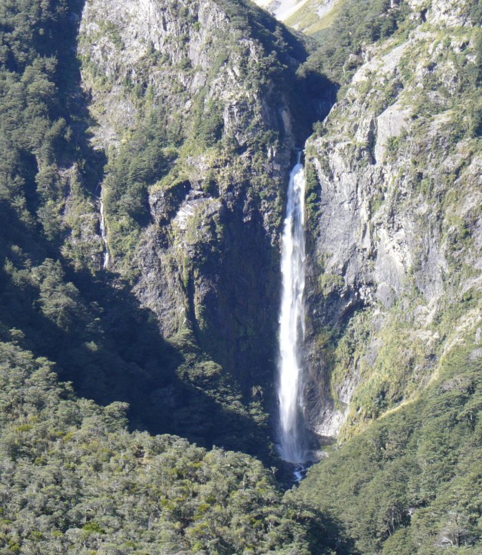
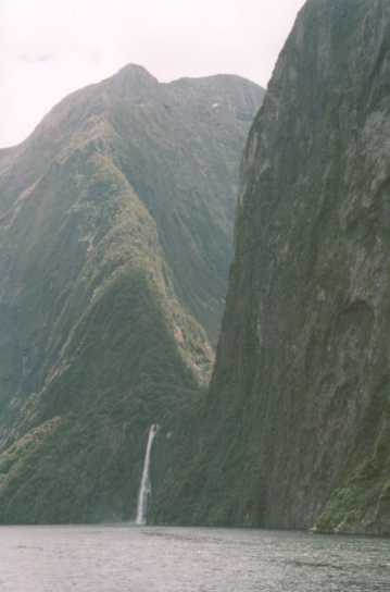
Stirling Falls
Stirling Falls is a 495-foot (151m) sheer drop, but possibly the most impressive feature is its
surroundings... |
|
... there's a wide valley behind, curiously shut off from the 'Sound' by that wall-like ridge, and the
cliff on the right of the photo goes up sheer to 3900 feet (1200m).
The 'sounds' (so-called) on the West Coast are in fact true fjords, which is why this area is called
(correctly) Fiordland.
|
|
|
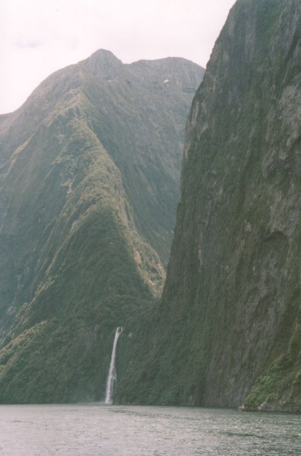
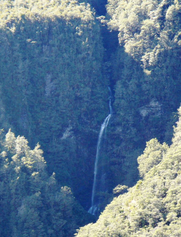
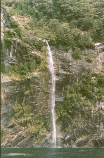
Fairy Falls
This is, I think, Fairy Falls, a very elegant waterfall on the southern side of the Sound. From the
contours (and if I've identified it correctly), the height appears to be around 100m (330 feet).
Tourist boats like to poke their bows close to the cliff, giving any hardy passengers in the bows
a thrill and (if the wind gusts suddenly) more of a soaking than they expected.
|
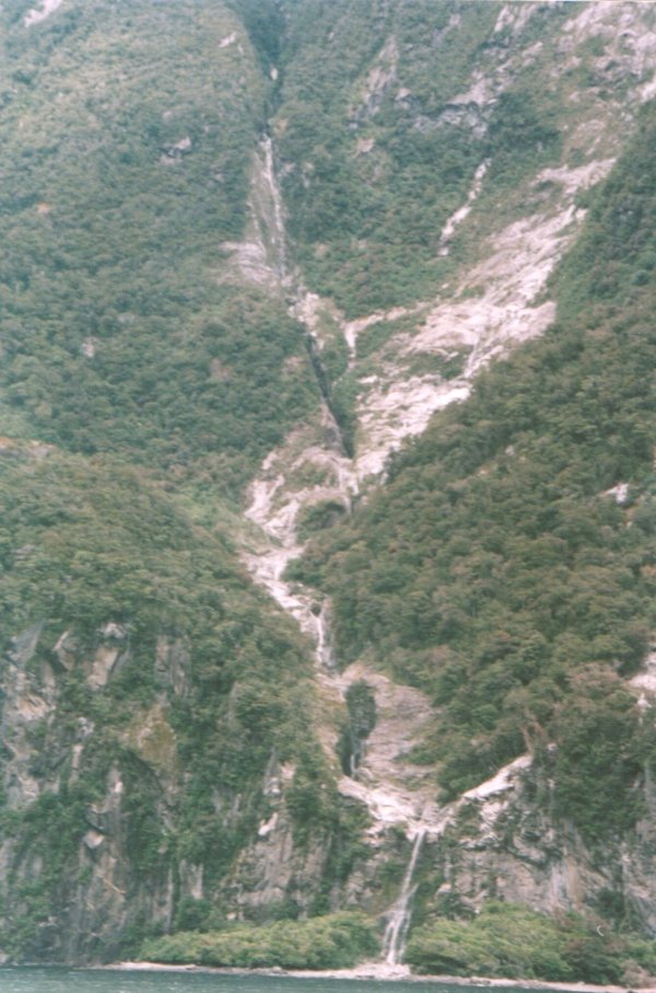
A little farther along, this small stream starts at around 4000 feet on the slopes of Mitre Peak,
and you can trace its route as it cascades all the way down to the sound.
The vertical bare strip of rock on the right hand side is very possibly the scar left by a 'tree avalanche',
when some tree clinging to the steep rock face lost its grip and came down in a cascade of
vegetation. |
|
|
And towards the entrance of the fjord, this stream starts in a deep gully high on the slopes of
the mountain and ends in a respectable waterfall onto a little beach. |
Palisade Falls
Meanwhile, on the northern side of the fjord, this stream starts high on the
slopes of the mountain called 'The Elephant'; according to the map, there are a 25m and a 55m
(80 and 180-foot) waterfall at its lower end. According to A Guide to New Zealand Waterfalls
(J T Cheng) this is called Palisade Falls. |
|
Heading north from Milford Sound, Jackson Bay (where the "West Coast" could be said to begin) is just 50
miles up the coast. 25 miles beyond that, by gravel road, is Haast.
But in the 50 miles between Milford and Jackson Bay there is - nowhere. Or as close to nowhere as
you can get. The coast of Fiordland must be the most deserted part of the country.
To get from Milford to Haast by road, one has to travel inland, south, then east, then north through Queenstown and
Wanaka, and finally over the Haast Pass to regain the west coast. The Pass itself is a surprisingly easy
road, considering it's crossing the Southern Alps. It is by no means a mountain road. The most dramatic
aspect is the sudden change, in just a few miles, from the dried-up bare tussock lands of Central Otago,
to the heavy rain-fed bush of the West Coast.
The next pass north of Haast (for anyone other than serious hikers) is Arthur's Pass, 120 miles to
the north; much more of a true mountain pass, and well endowed with waterfalls. Arthurs
Pass village is a great place to spend the day on a fine summer's day, the air has that fresh
Alpine feel to it.
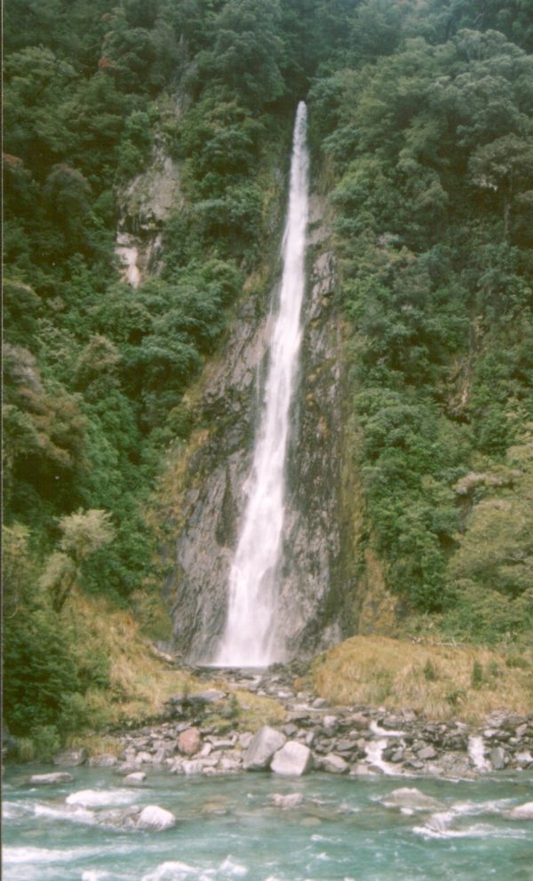
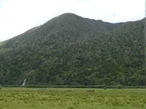
Brums Creek (Paddock Hill) Waterfall
In the 'Waterfalls seen from a train' category... the return trip of the Tranz Alpine
Express from Greymouth to Christchurch, between Moana and Jacksons (and 25 miles before the
Pass itself) circles round the modestly named Paddock Hill, a strange, isolated bush-clad
mountain of 3700' (1135m) height. Strange in that, in this mountainous region, the hill is
entirely surrounded by flat pasture land (and a large lake). The Hill is large enough to have
a number of sizeable streams running off it, one of which, Brums Creek, ends in a eyecatching waterfall.
|
|
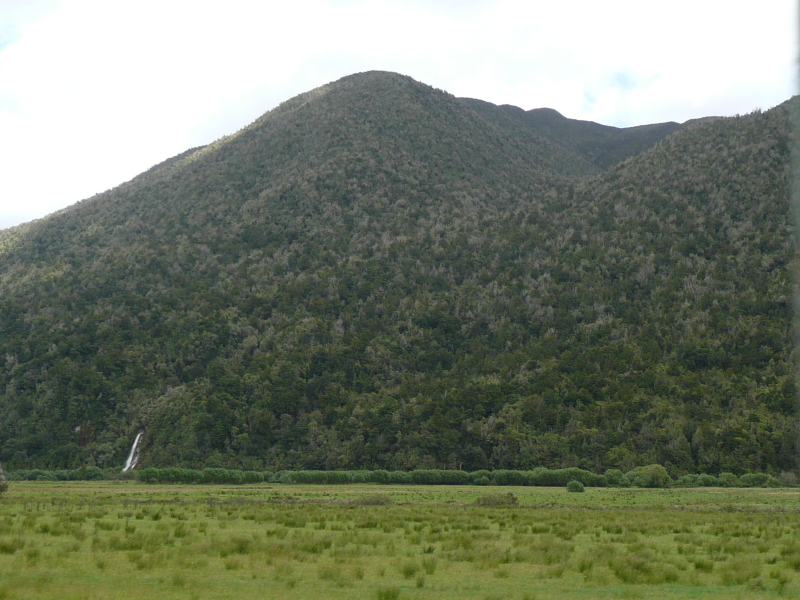
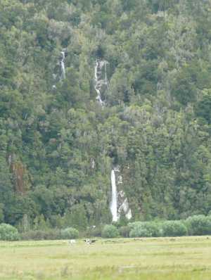
| As the train races across the flat valley, more waterfalls and cascades come into view.
By my usual calculation, I estimate the lower fall to be 32m (105 feet) high. |
 |
|
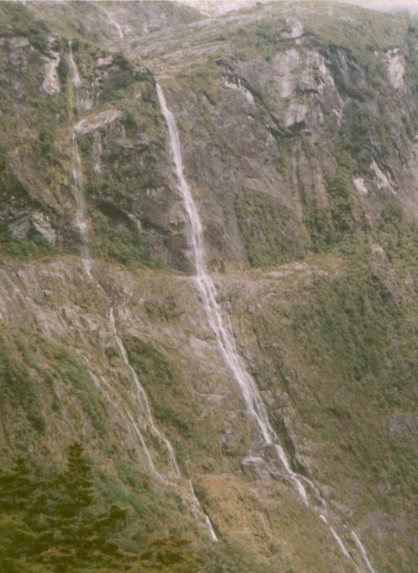
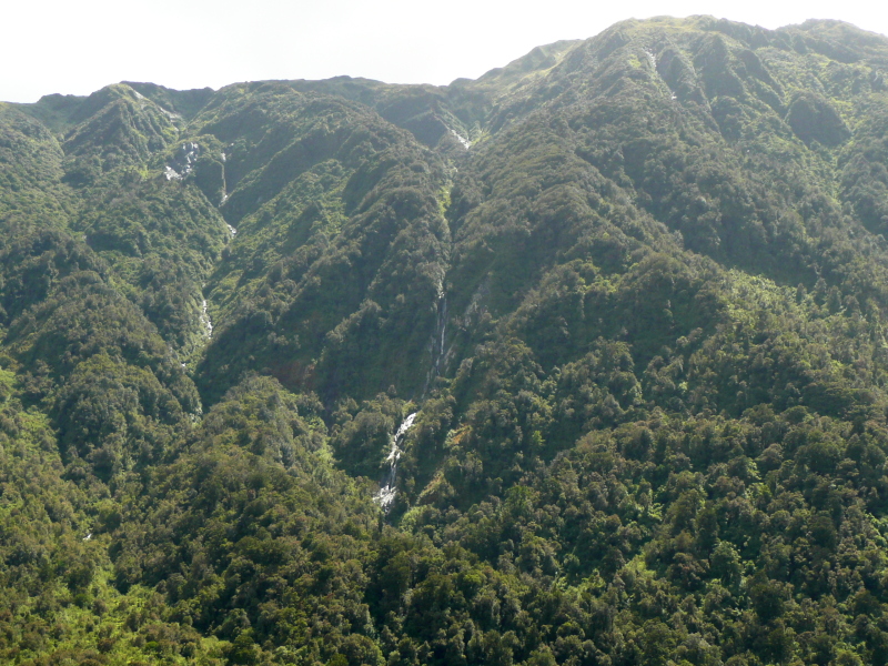
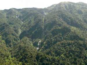
Alexander Range
As the train winds up the valley of the Taramakau River, you can look across to the thickly bush-clad slopes of
the Alexander Range. It's hard to tell which are waterfalls and which are wet rocks gleaming in the sun.
|

|
This is the West Coast, with onshore prevailing winds and mountains rising close to the coast, hence heavy rainfall. Everything
is wet, and steep, these are notable waterfalls in their own right, but in these surroundings they don't even rate a name. |
|
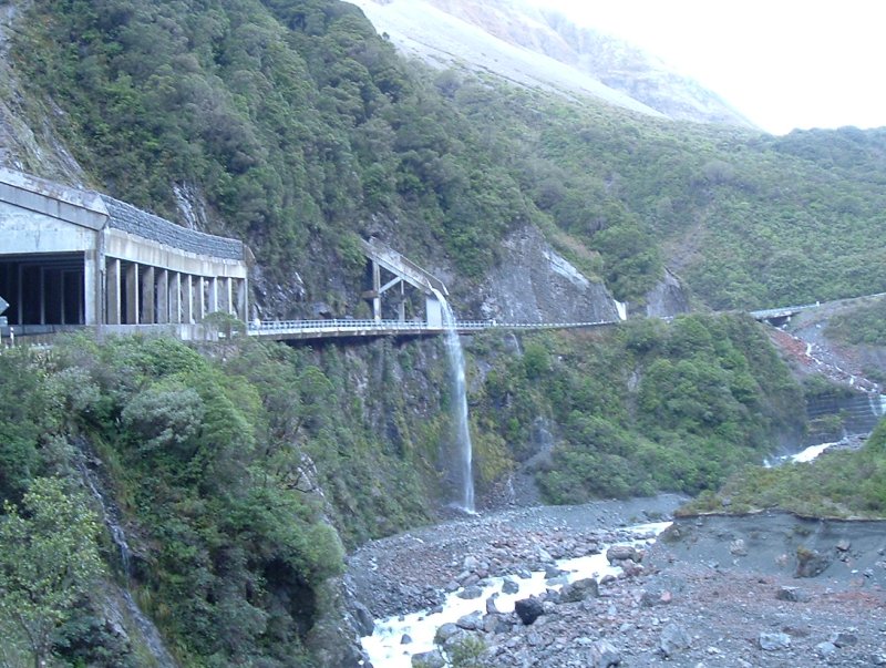
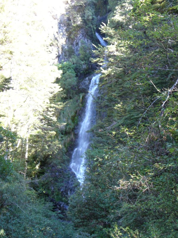
Reid Falls
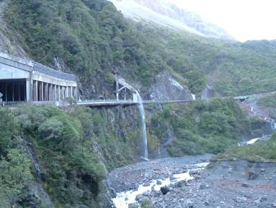
Climbing steeply up the narrow gorge above Otira, towards the pass itself, the Arthurs Pass road
passes underneath this waterfall.
It looks artificial, but I guess the stream was always there...
it may have been a higher fall (or cascade) before the sloping concrete chute was built.
(The railway line is deep in tunnel beneath this point).
|
From a viewpoint beyond the top of the steep grade, you can look back down the gorge itself, and also
across the gorge to this waterfall on the slopes of Mt Philistine. That's the Otira River flowing past the
foot of the slope - I think. (If I've remembered the locality correctly).
There are many falls like this in the area.
This picture, and the one above, were taken in the early morning, hence the diffuse lighting and the
paleness of the sky. |

|

|
Avalanche Creek falls
And now, in Arthurs Pass village itself... I took the Tranz Alpine from Christchurh to Arthurs Pass, and had a pleasant five
hours wandering around Arthurs Pass before catching the return train back. A nice excursion on a fine day.
Avalanche Creek comes down right behind the tourist Information Centre, just across the road from the station,
in a series of falls stretching down the mountainside. A short track leads to a viewpoint for the lowest
fall. As can be seen, the bright sunlight causes dark shadows in the deep narrow gorges and a headache for photographers. |
|
Backing away from the base of the fall, towards the Bealey River, more of the slope comes into view.
This was taken a little later in the day, when the sun was at more of an angle to the slope, which actually
helped visibility of the falls in their gorge by reducing the contrast. Even so, I had to tweak this shot
strongly to get the falls to show up.
The topmost fall is shown as 80m (262') on the map.
|
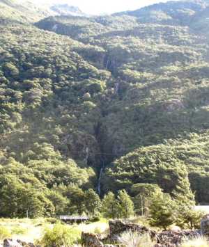
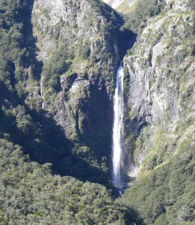
Devils Punchbowl Falls
The valley of Devils Punchbowl Creek cuts deeply into the face of the mountain behind.
This is undoubtedly the prize waterfall of the Arthurs Pass area, and I think the best-looking fall in New Zealand.
It's a good-sized fall too, I've seen it quoted as 524 feet (160m) or 439 feet (131m). So far as I can judge,
scaling off my photos, I think the higher figure is nearer the mark.
This view of it, across the Bealey River, is just an easy level half-mile walk from the station.
|

|
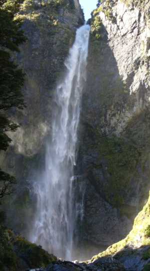
To get closer, you can follow Devil's Punchbowl Track, through pleasant woodland, but a stiff climb
up wooden steps as it climbs the right-hand hillside, then drops again into the valley to arrive at a viewing platform
at the base of the fall.
There are fascinating patterns in the water as it falls. It may look even better later in the day, with the sun on it,
or then again, not.
|
|
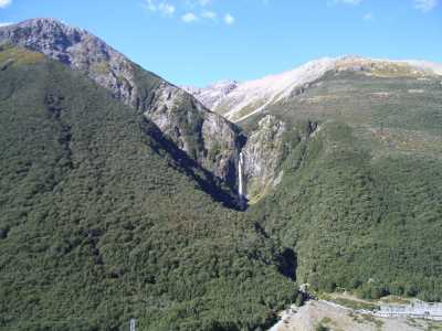
But the best view of all, I think, is from the lower reaches of Scotts Track, up the opposite side of the main
valley. It's a moderate climb, actually easier than Devil's Punchbowl Track, and gives great views not only
of falls, but also up and down the main valley.
A classic view of a classic waterfall.
Note the little companion fall to the left, which is probably bigger than some falls featured by name
on these pages.
|
|
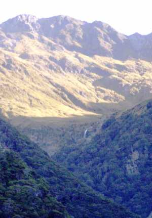
And - yet another photo, I can't resist it - the falls, seen in the landscape. Mt Cassidy to left, Mt Aicken to right.
This is what 28mm lenses are for! |
|

|
Bridal Veil Falls
Just to the north of Devils Punchbowl creek is Bridal Veil Creek, also cutting into the face of the
mountain. The map shows two falls on it, the lower of 60m, the upper of 108m. There's a track to
it which starts from the same bridge across the Bealey River as Devils Punchbowl track, but I didn't take it,
though it is, apparently, an easy walk. Instead, I just saw a long-distance view of the falls from
Scotts Track. I think this is the upper falls, the lower falls being hidden in its valley.
The bright sunlight and deep shadows again made photography extremely difficult. This shot required
major fiddling with camera exposures at the time and subsequent tweaking with Gimp to render the
waterfall readily visible.
|
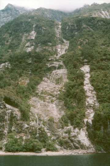
Rough Creek waterfalls
Rough Creek, the next stream to the south of Avalanche Creek, comes down to the valley at the southern end of
Arthurs Pass village. According to the map, there are four sizeable falls on its upper branches, none of which
seem to be visible from the road, but whether the steep foot track shown on the map heading up towards Mount
Bealey affords a better view, I don't know.
This one, high up on the northern branch, counts as another 'waterfall seen from the train', in this case when
leaving the Pass to return to Christchurch. The map says it's 100m high. |
|
The Bealey River runs across the base of the slope
at the far edge of the grassy flat
|
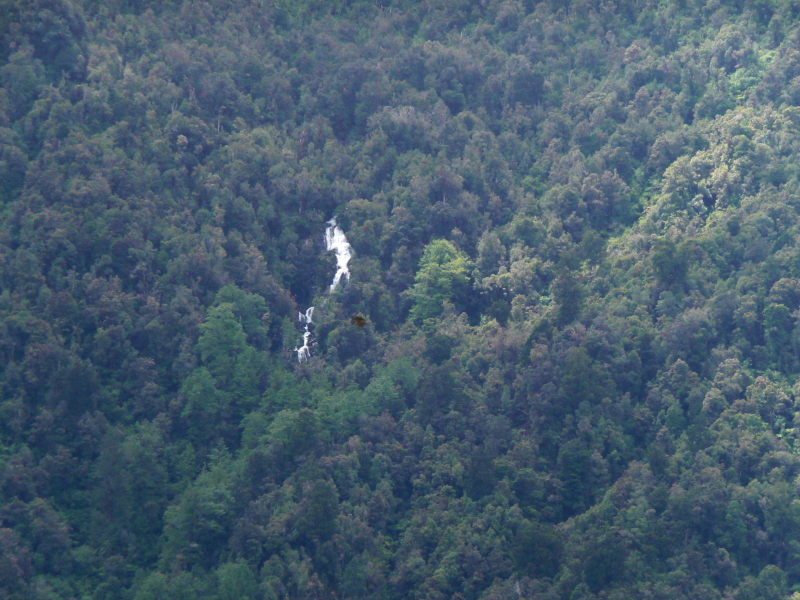
Hidden Falls
And this one is not 'seen from the train' but 'heard while waiting for the train'. Neither the
waterfall, nor even the stream, is named on the map - 'Hidden Falls' is just my name for it.
While standing on the station platform, you can hear a waterfall (and it isn't Avalanche Creek). Intently
searching the slope opposite, across the Bealey River, you can just make out, hiding in the trees,
a good-sized waterfall. The upper photo is all you see at first.
|
|
Looking intently, you can just make out the falls in the shadows of the trees. Photographing it on
a sunny day is almost as difficult as discovering it - the photo was taken with exposure compensation
override on maximum. An overcast day would be much better.
By the usual arcane methods, I calculate the height of the visible portion of this fall to be 18m or
59 feet high.
|
|
|
Sawmill Creek
East of Arthurs Pass, across the divide, everything is much drier. There are a few waterfalls, but nothing like the western side
of the ranges. The slopes are steep enough, but the volume of water just isn't there.
This is Sawmill Stream, on the north side of the
Waimakariri River valley. I don't know these mountains, but it looks to me like an avalanche has been down here recently.
|
 |