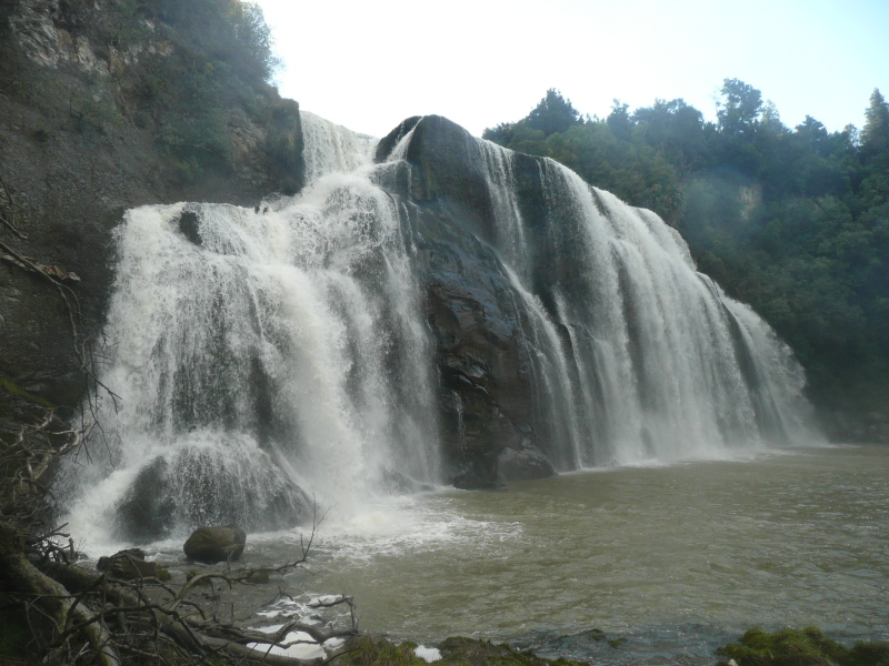
Waipunga Falls
East of the central plateau and the divide formed by the Tararua and Ruahine Ranges, the broken hilly country of Hawkes Bay and the Wairarapa stretches down the east coast.Heading south-east on the Taupo-Napier road across the high flat plains, Waipunga Falls come as a surprise. Easily seen from a signposted and rather bleak sealed viewing area (it would have been more pleasant in gravel) just off the main road. The falls are unexpectedly impressive, since the landscape looks arid and scrubby, not the sort of countryside to expect good-sized rivers or big drops.
The falls partly visible to the left are Waiarua Falls. Unfortunately the viewing area is as far as you can go, steep slopes and thick bush prevent you from getting any further round to better view them.

Waipunga Falls are the right hand (eastern) ones; Waiarua Falls the western.
This is the best shot of Waiarua Falls you can get from the Pohokura Road track

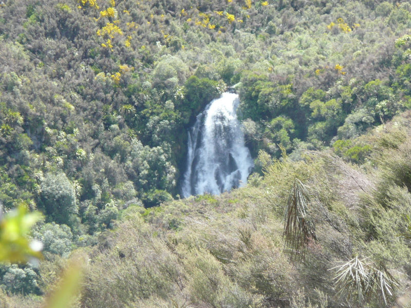
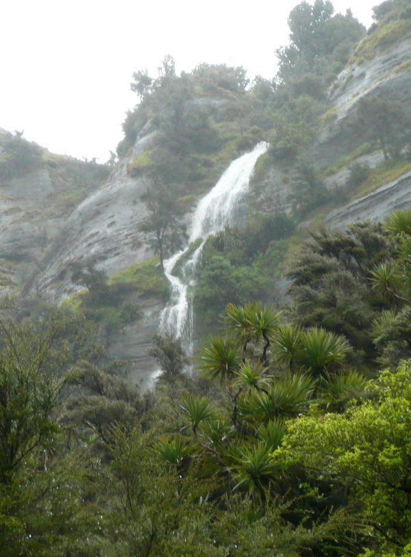
Pungahuru Falls
Also within 1/4 mile of the Taupo-Napier road (as the crow flies) is this rather nice waterfall, where the Pungahuru stream drops into the gorge of the Mohaka River. Not visible from the main road, you have to turn down McVicar Road a half-mile north of the Mohaka bridge, then take a side track (signposted for anglers and please shut the gate!) down towards the river.There, facing you across the fast-flowing Mohaka River, is an amphitheatre of high pale cliffs with a fringe of pines on the top and a small side valley from which the Pungahuru stream falls. Very peaceful, yet imposing, the spot has something of a 'lost world' atmosphere to it. You feel you are there by permission of the river.

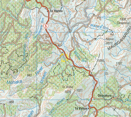
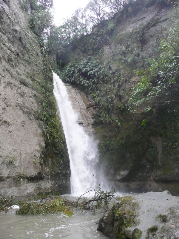
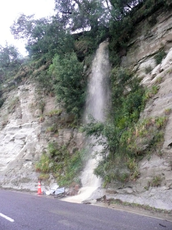
Te Ana / Tangoio Falls
12 miles out of Napier on the Wairoa road is Tangoio Falls Scenic Reserve. I visited this after two days of torrential rain, when my excursion train was cancelled due to slips on the line, roads were blocked, and there were impromptu waterfalls down every roadside cutting. The track to the falls immediately disappeared in a raging torrent so I went to Shine Falls instead. Next day I came back, the river was still high and the footbridge had been carried away, but the tree that did it was conveniently jammed against the wreckage of the bridge and was spanning the stream in its place.A pleasant walk up alongside the side stream (with no hint that the main road is just above) led to Te Ana Falls, which looked good with the high flow.
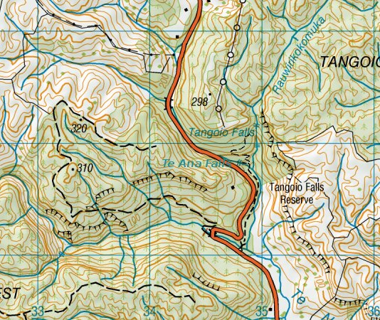
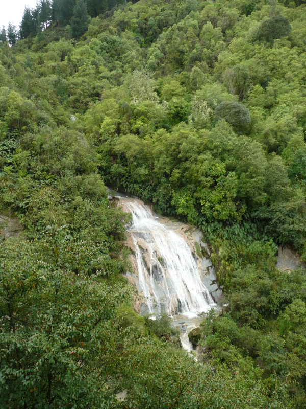
A few yards before Te Ana Falls, the path branches, the track to the right is just signposted 'Waterfall 15 minutes'. It takes all of that, mostly uphill, and it's hardly worth it, the fall (which I suppose is Tangoio Falls though no sign names it) is just a sheet cascade over sloping rocks and, even in this weather, the flow was not great. The map shows another fall lower down but this wasn't visble from the overlook.
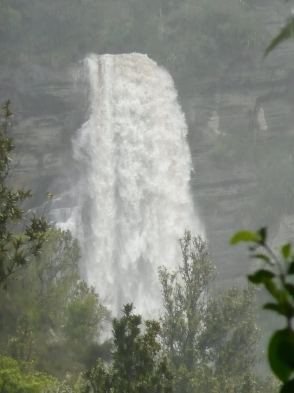
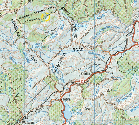
Shine Falls
Sometimes you can have just too much water in a waterfall. Shine Falls is definitely one of these.They're a few miles down a gravel road (Heays Access Road) off a loop road (Matahorua Road) off the Napier - Wairoa highway, and a couple of miles walk up the Boundary Stream Track. It's an easy walk, only a couple of mild hills.
The path starts off across paddocks with impressive bare rock faces high above. Off one of these yet another impromptu cascade was flowing.
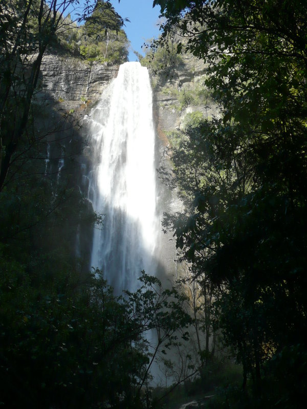
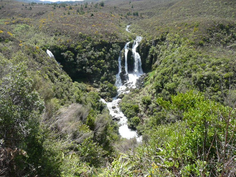
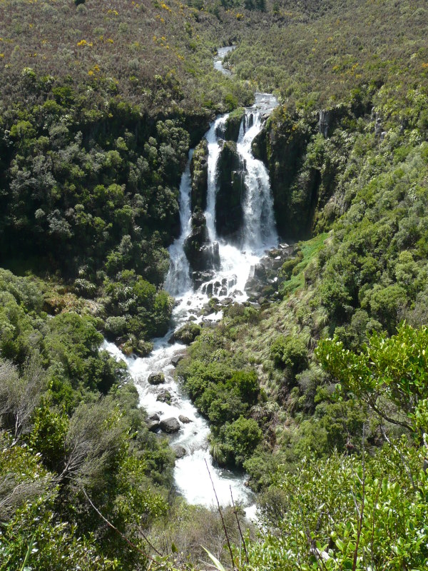
Waihi Falls
There don't seem to be many waterfalls down the east coast south of Napier. Probably the most notable one is Waihi Falls. (Not to be confused with the better-known Waihi township on the Coromandel east of Auckland).This is an unexpectedly big waterfall, especially considering it's only on a 'stream' with a modest catchment area.
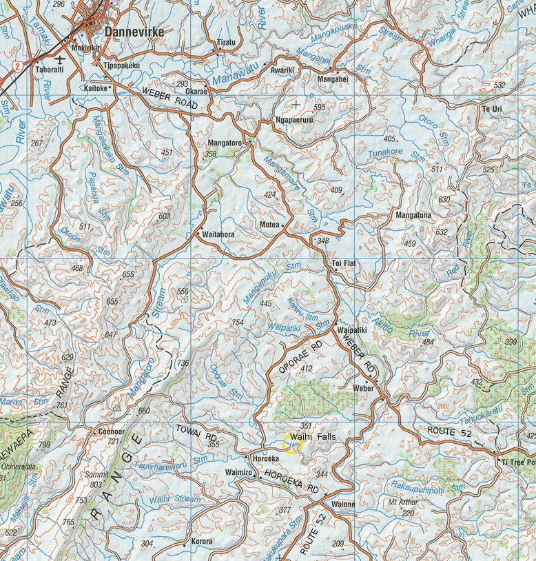
The falls face east, so the best time for photos is probably morning - not late afternoon on a clear winter day as here.
They're reputed to be 23m (75 feet) high. People have gone over them in kayaks, though not always successfully.
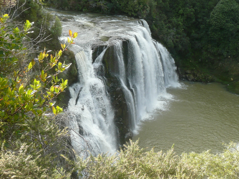
Seen from the parking area